Advertisement
NASA Satellite Uses Lasers To Help Scientists Understand How Quickly Polar Ice Is Melting
Resume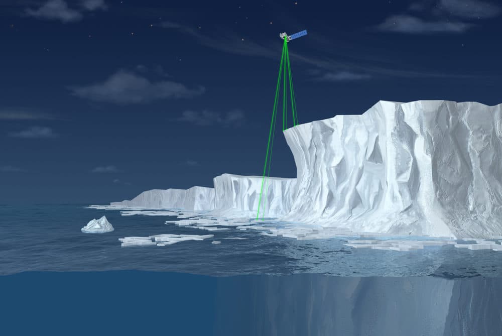
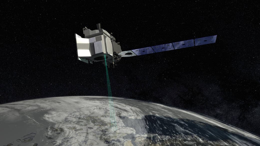
NASA's newest Earth-orbiting satellite ICESat-2, or Ice, Cloud and Land Elevation Satellite, will use laser technology to measure tiny changes in the planet's polar ice sheets. The data will offer the most precise look yet at how rising global temperatures are affecting ice melt and sea level rise.
Here & Now's Lisa Mullins talks with Helen Fricker (@helenafricker), a professor of glaciology at the Scripps Institution of Oceanography in San Diego who helped NASA develop the ICESat-2 mission's scientific goals.
"We've been working on this mission for more than a decade. The concept of the mission had been in our heads, but we haven't actually seen it sort of on the spacecraft and being sent into space," Fricker says of the satellite's Sept. 15 launch. "It was actually quite overwhelming."
Interview Highlights
On how ICESat-2 works
"The instrument itself is about the size of a Smart car. It carries lasers, and the laser will send a laser pulse down to the Earth's surface and bounce back and it times how long it takes. It does that many, many, many times, and it will build up a picture of the Earth's surface and basically just keep doing that for as many years as it's in orbit."
"The ultimate thing that we're trying to get to is, how much ice will we lose and how quickly will we lose it?"
Helen Fricker
On what the satellite will help scientists observe
"What we can do is we can look at where the mass loss is coming from. So for example, on an ice shelf, you might get greater melt rates along the front of the ice shelf or at the grounding line where the ice is in contact with the ocean. We can see from that information how fast the ice is responding to changes in the ocean and the atmosphere, and over time, we can build up a time series for every location on the ice sheet and figure out what's causing those changes. So, why is the ice either building up or drawing down in that particular region?"
"We can parameterize these processes better and put them into models so that our models will be more accurate and predict future sea level scenarios, so that we can then send that information to planners for preparing for the future. ... As the climate is warming, we are seeing changes in the sea level — sea level is rising — but the ultimate thing that we're trying to get to is, how much ice will we lose and how quickly will we lose it?"
On how ICESat-2 improves upon the original ICESat
"ICESat flew 2003 to 2009, it was a single profiling laser altimeter, so it just collected measurements along a single ground track. ICESat-2, the concept is slightly different: We split the beam into six beams, but then there's two beams on the side that form a bit like an outrigger, and it will therefore capture more of the surface."
On when scientists can begin to access the data
"We are at the moment waiting for the laser to be powered up and the door to open so that the information comes out. And in about the middle of October, about a month after launch, we should start getting the first data back, and we convert the data from the instrument into surface profiles and compare them with surfaces that we know to see if they're giving us the right answer.
"It's going to be all hands on deck for several months while we work out what these data are telling us, and we really wait. It's incredibly exciting."
This segment aired on September 20, 2018.